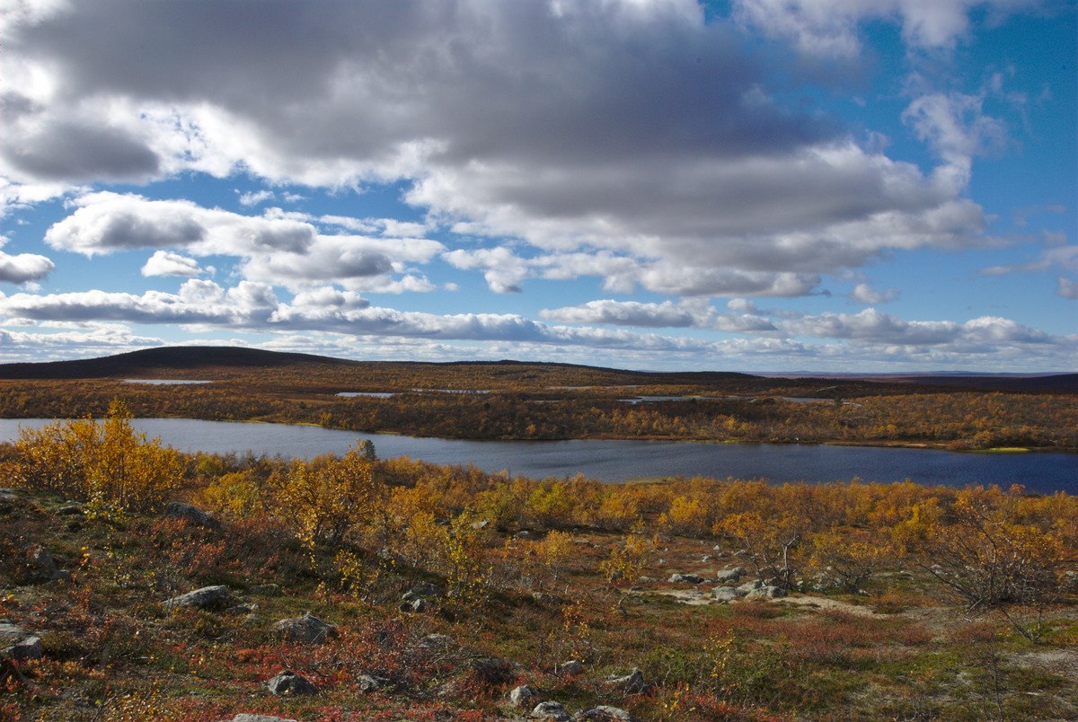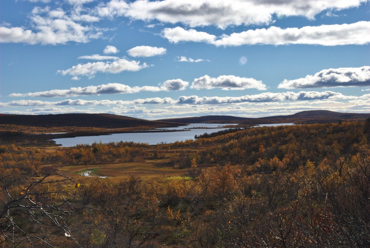

After a busy summer and not doing much hiking, the autumn colours and the predicted sunny weather made me decide to go on a short hiking trip in the region. Since I aimed to avoid popular hiking routes, I decided to once again hike into the Pöyrisjärvi wilderness area, and found Olkojärvi as being a seemingly nice spot (according to the map).
Not even once have I been able to sleep in my tent this summer, and I certainly wanted to change this fact! It seemed to me to be a good time to go hiking hiking in early September, as mosquitoes should be gone, and the autumn should put the landscape in a colourful appearance. When I talked about my plans with a friend and neighbour, he happily took up the idea for a short hike, and asked for a few days off as well. Unfortunately we still haven’t been able to leave together for the trip, however, a day before I left Hetta, we agreed to meet on a specific spot on the shore of lake Olkojärvi.

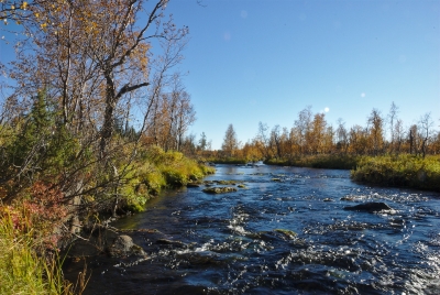
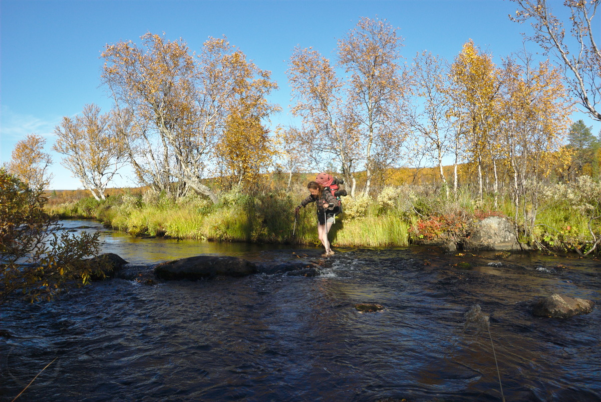
That having settled, I continued to pack my backpack and left home Thursday afternoon. I first walked along the skiing tracks that start just behind our apartment and followed the regular (summer) hiking trail toward Näkkälä, until I reached the Näkkälän välitupa – an open wilderness hut pretty much in the middle between Hetta and Näkkälä. From there I turned east, where according to my map, some sort of trail (it looked like a quad-bike trail on the map) should leave from the Näkkäläjoki river into the tundra of the Pöyrisjärvi wilderness area. Because of my late departure, the sun was already pretty low when I arrived at the river. I dropped my luggage and went up and down the river to search for a good spot to cross, since I have heard earlier, it would be a bit tricky to cross this river. However, I couldn’t find the spot where the trail was supposed to be, and because it was already getting dark now, I crossed where I had dropped my backpack, since I still wanted to reach the other side the same day. Not at least, because I was standing more or less in the middle of a huge bog but saw some apparently dry forest on the other side of the river – after maybe just walking 30 more meters through a mire. Unfortunately it got already so dark, that I couldn’t see anymore what was under the water surface of the river, which didn’t really help fording Näkkäläjoki. So with my hiking poles I carefully sounded the river bed before every single step. This way, it took my some time for fording, however I managed it keeping dry – except for my feet of course. While I was building up my tent, it already got really dark, although the clear sky revealed a wonderful heaven, very rich in stars. Even though I hoped to see some northern lights (since the days before there were some amazing northern lights to see over Hetta), but the cold of the clear night made the inside of my warm sleeping bag to a cozy place, and the tiredness made me fall asleep pretty soon.

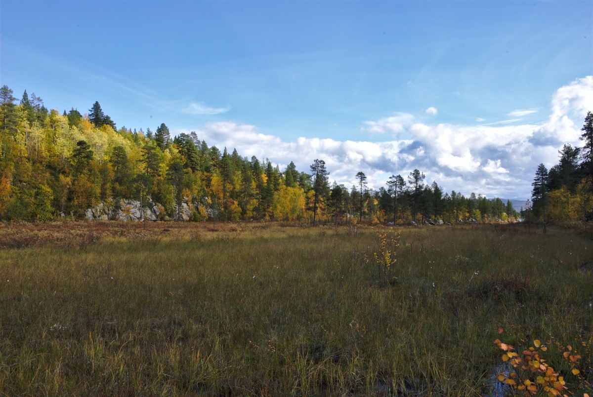
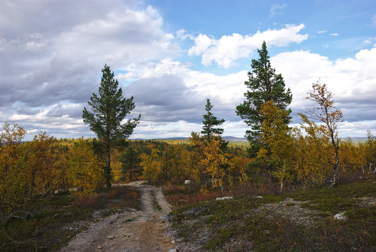
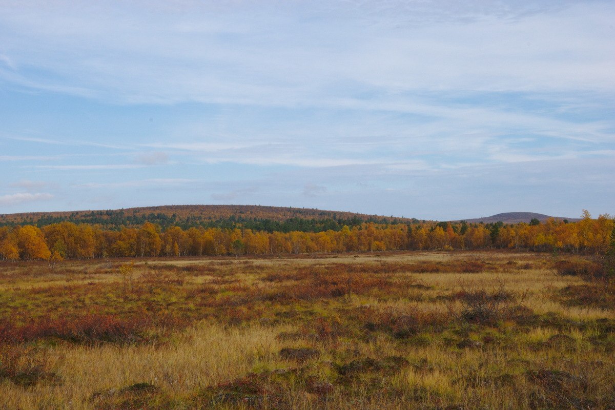
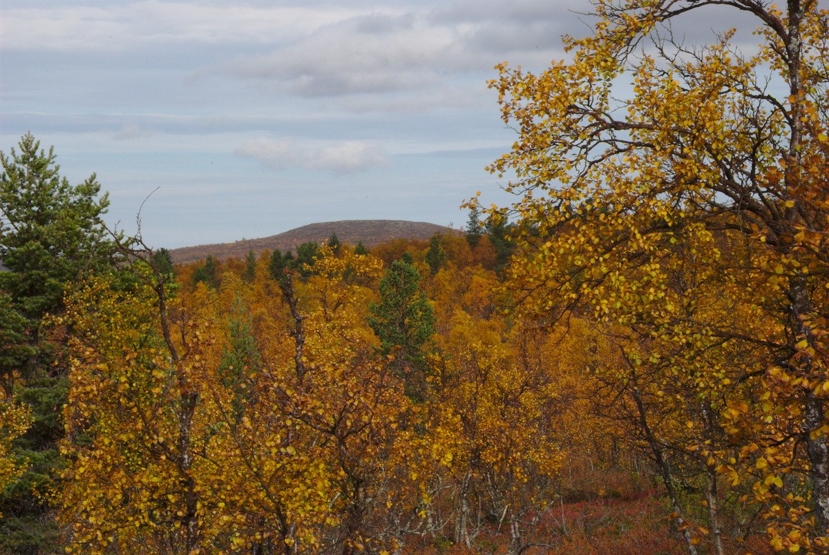
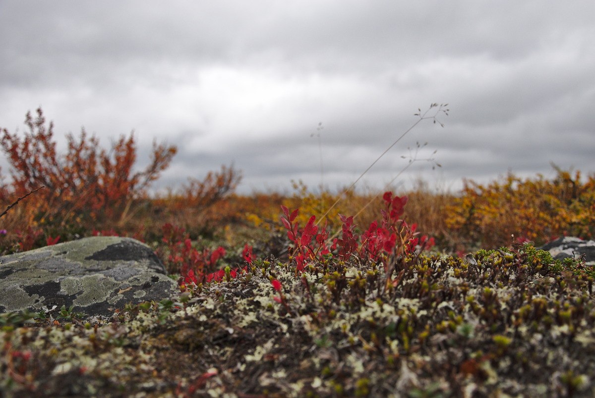
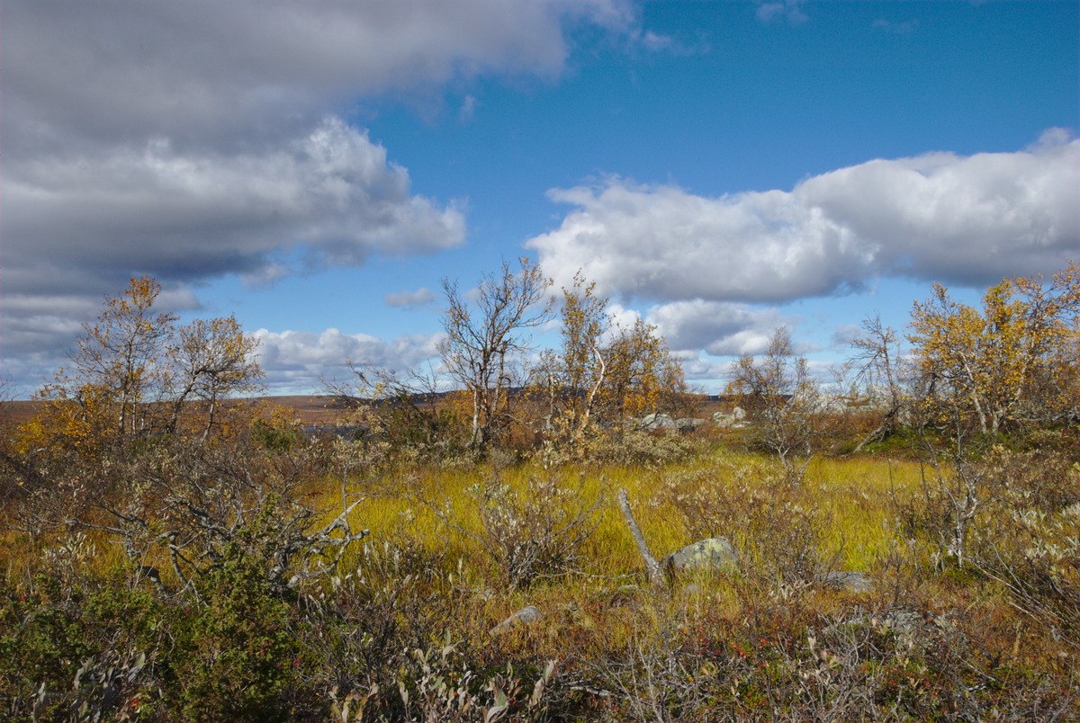
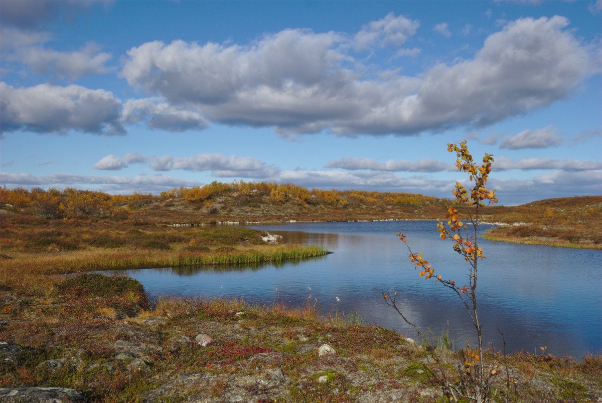
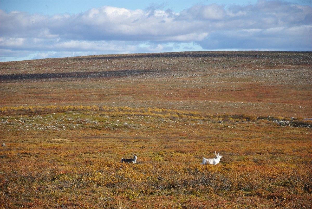
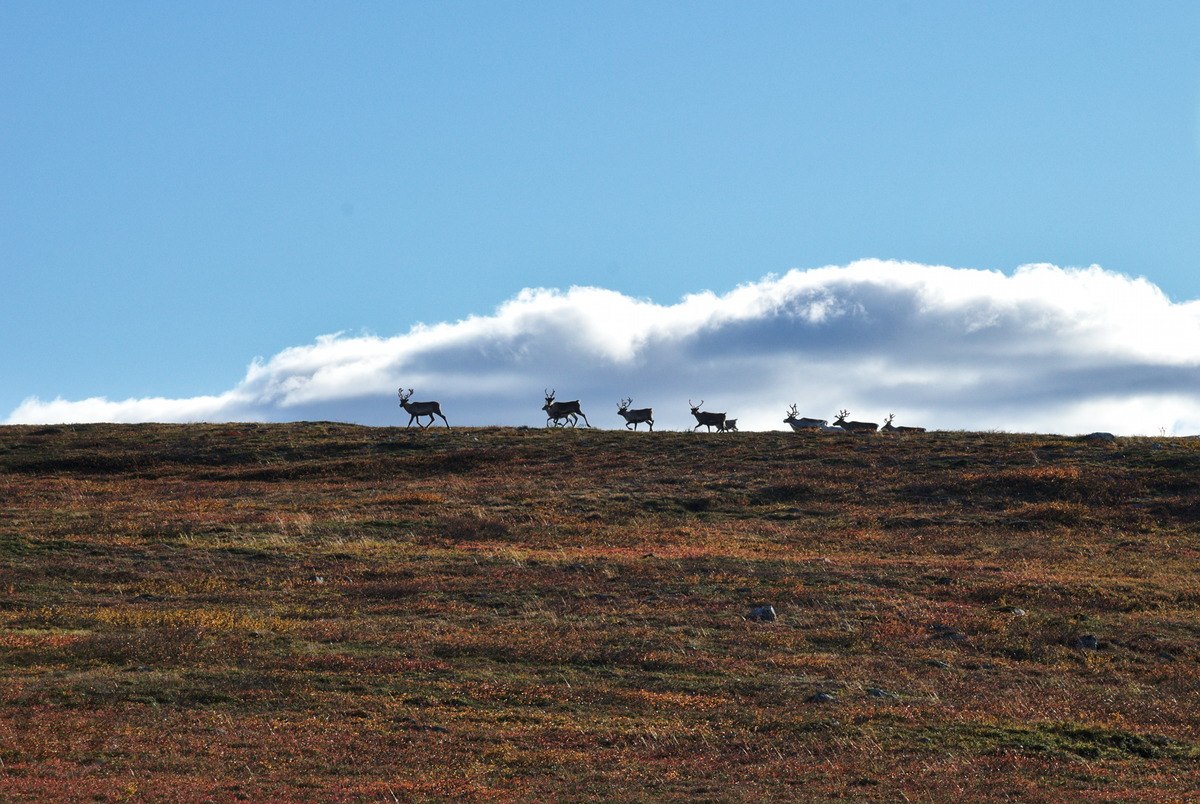
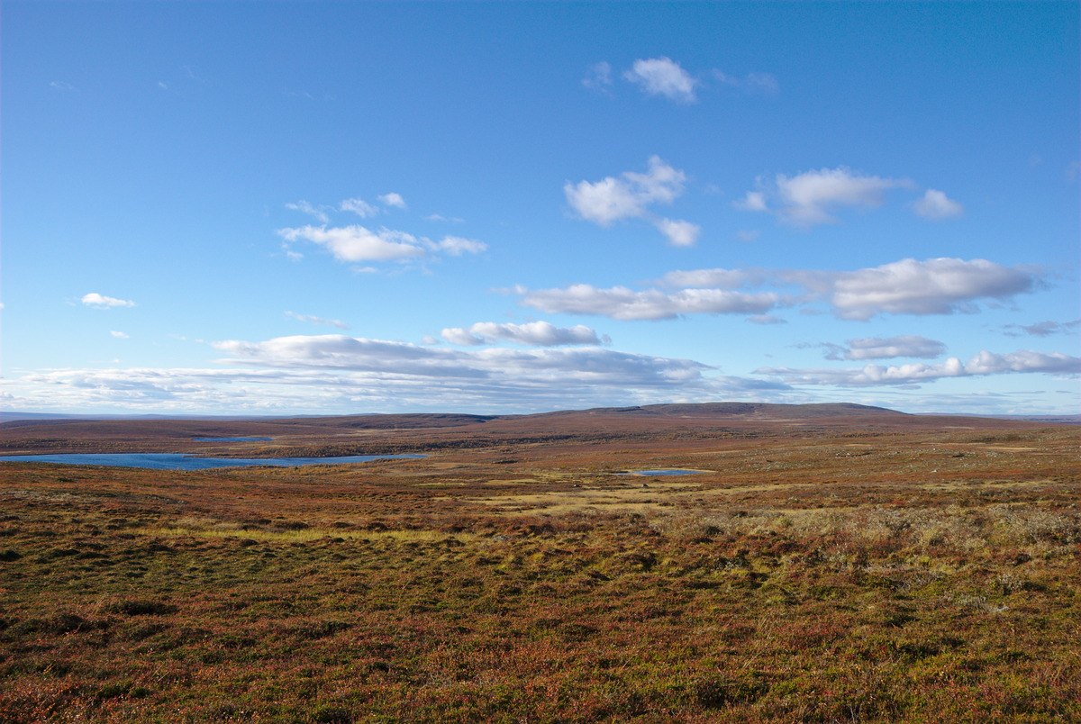
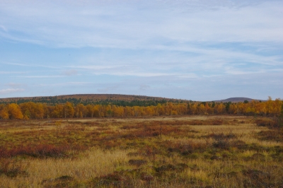
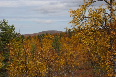
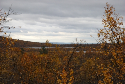
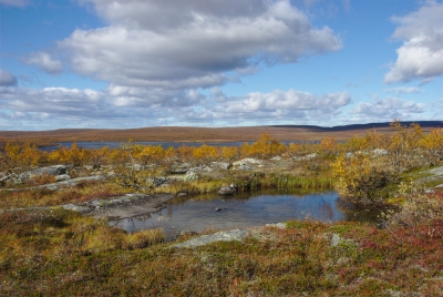
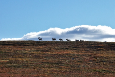
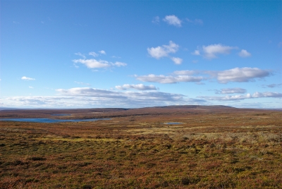
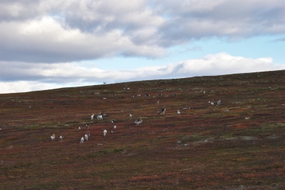
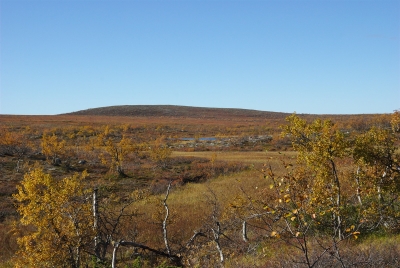
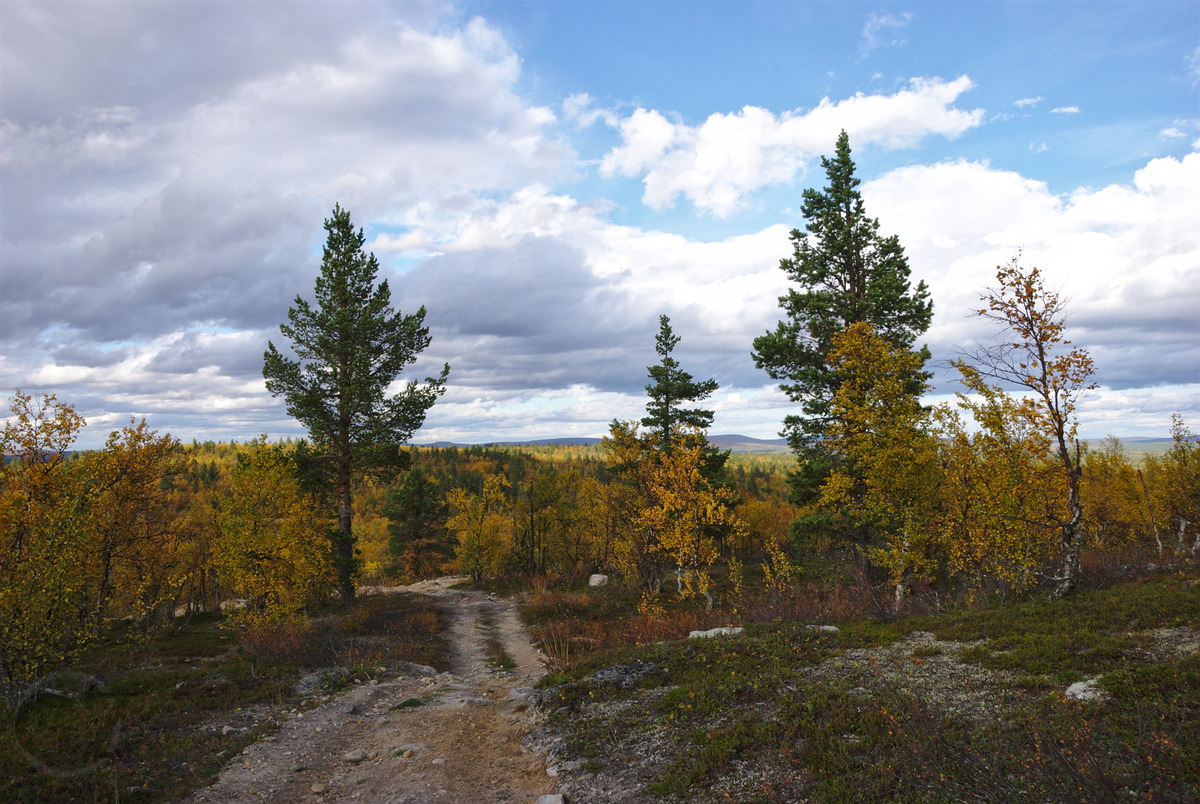
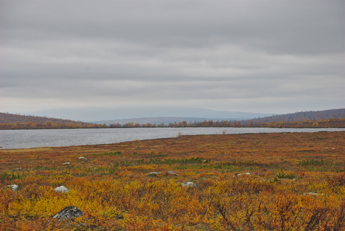
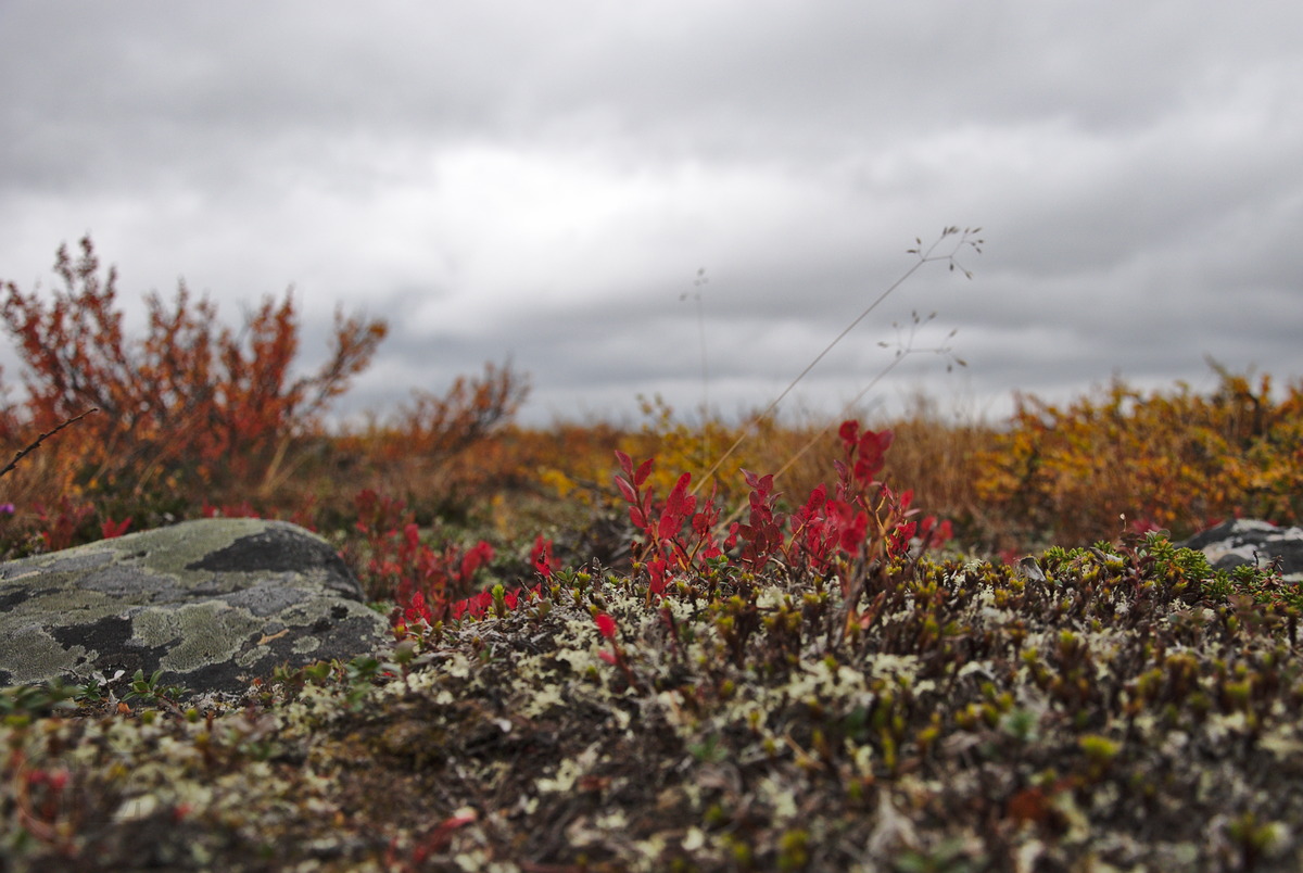
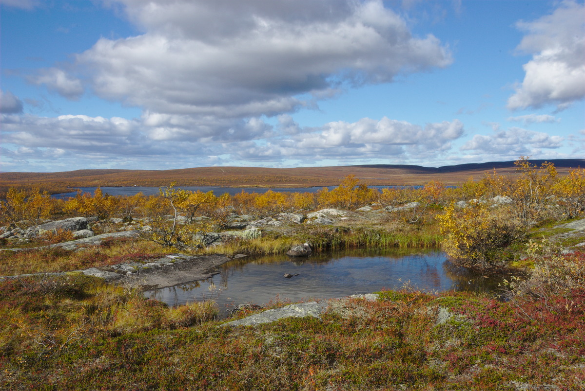
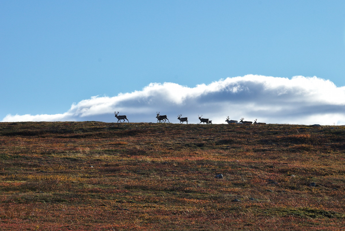
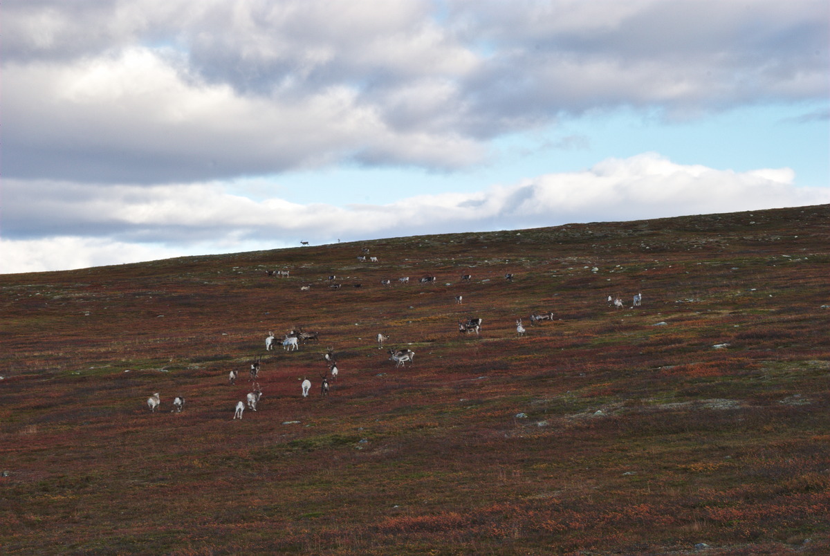
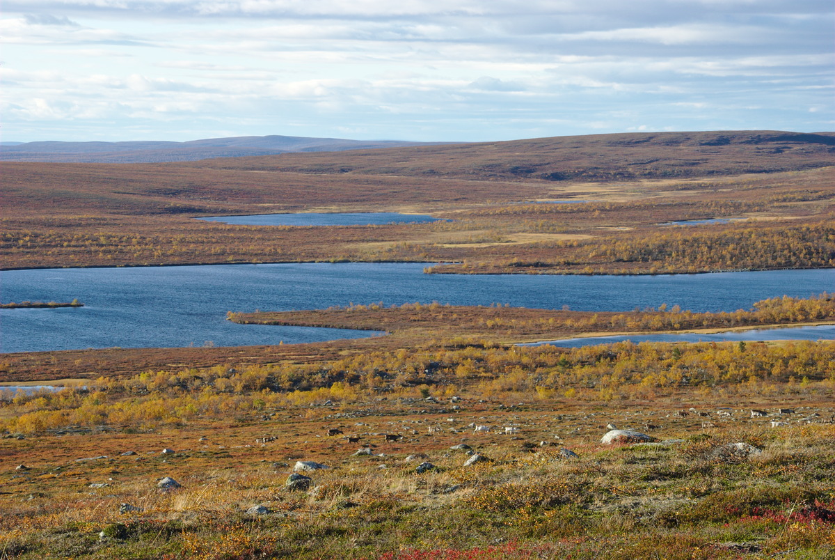
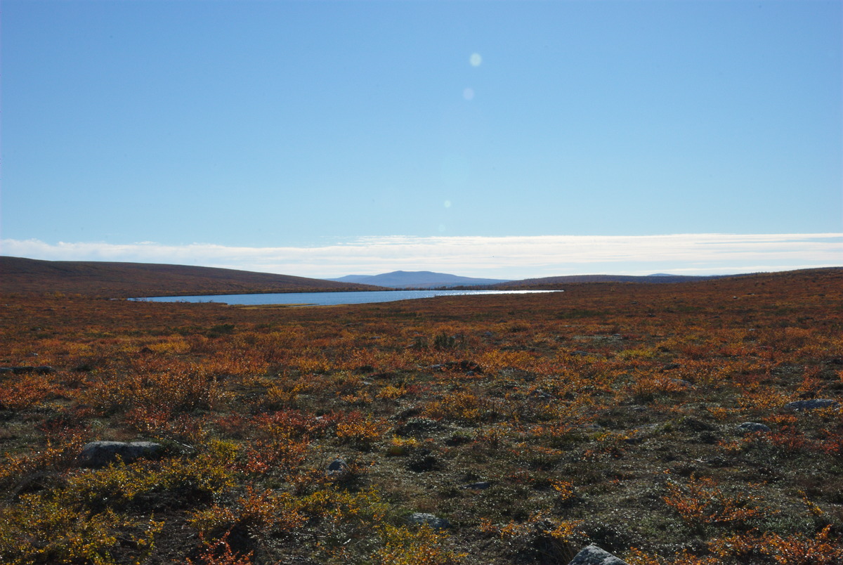
The next day I slept rather long, as the sky turned cloudy over night, and no direct sun light hit my tent. Nevertheless, after getting up I started to prepare my breakfast, and already while eating, the sky turned blue again and dried my tent from the condensation water. Since the track that I tried to find the day before looked promising to easily hike up the hills to the tundra, I once again put some effort in finding it. Too much, as it turned out, since I once again couldn’t find, but rather found myself in the middle of the bogs again. After some back and forth, and left and right, I finally found my way through the numerous mires, a sea of bushes, that actually was quite hard to pass, and some smaller brooks I had to cross along the way. Nevertheless, I safely found my way up to the fells, even though it took some time and physical effort, because the terrain remained rather exhausting to hike for some more time. One particular thing in this area is: Usually you would think, the higher you hike up the mountains, the less mires you would find; however, for this region that assumption is invalid. On the foot of Čorroaivi and along the valley I hiked up, I discovered a really huge bog, that I nevertheless successfully avoided by early enough crossing the brook, which was bringing down its water to Näkkäläjoki. Fighting myself through a birch forest with lot’s of bushes, I finally reached the lake Ragatjávrrit, where suddenly a new world started: Just by going over the edge of a hill, I was suddenly standing at the beginning of the tundra area, that spread to the east, west and north of this beautiful lake. It was one of those places, where after crossing a certain point, the vegetation completely changes, even if the altitude does not.

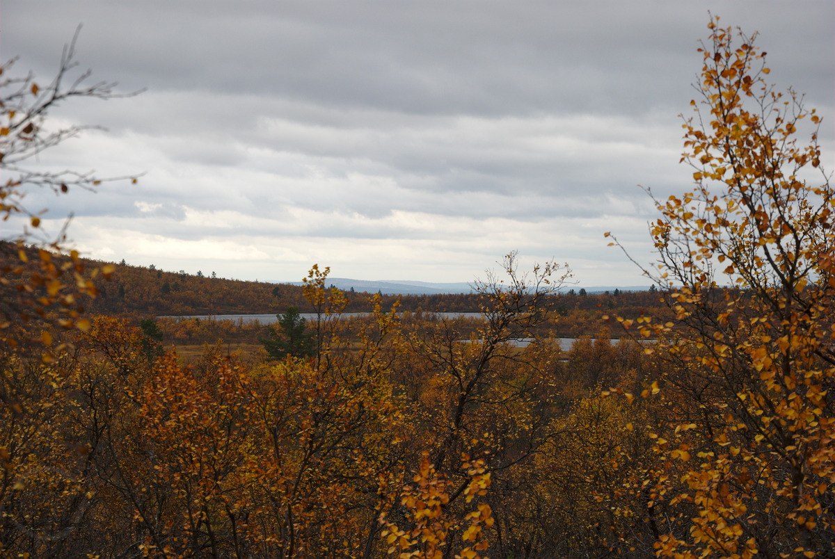
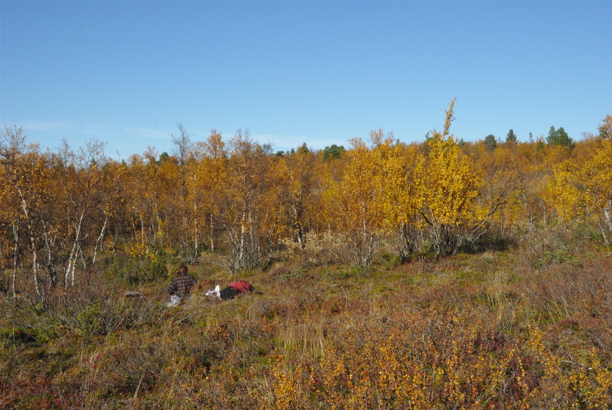
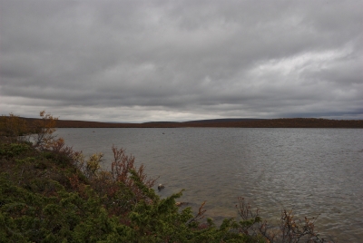
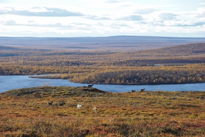
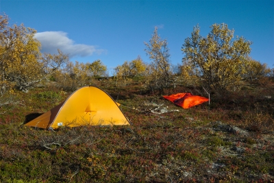
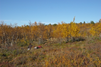
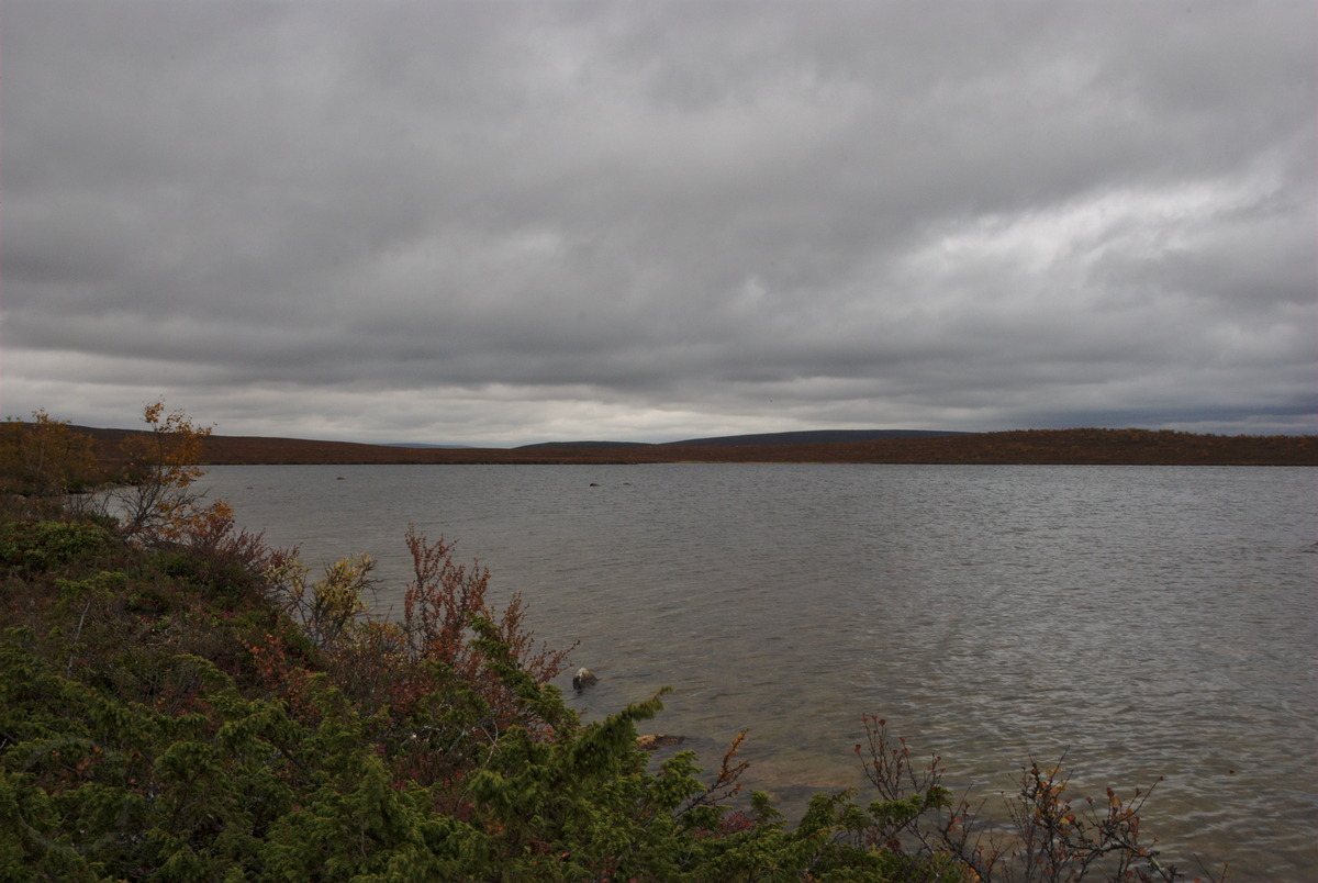
Since the clouds were getting thicker again and in the south it already looked a bit like rain, I decided to not make any longer breaks but to continue quickly to Olkojärvi, to the meeting point with my friend. On the map the few kilometres looked rather easy – despite the few bogs on the way, however, in practice I first needed to find my way through. While I was already getting tired feet and stumbling around in the bogs, I made a really fortunate discovery: Only in a very small bog I found loads of most delicious and perfectly ripe cloudberries. This came to me very surprising, since along the way most cloudberries have already been dead (as they are supposed to be at this time of the year). However, in this particular and small spot, about half of the cloudberries were just perfect! Although there already have been some nights with minus degrees, which usually is lethal to these delicious berries, the bushes under which the cloudberries where growing, seem to have protected them. So, despite my effort to reach Olkojärvi before the expected rain, I simply had to make another break to pick up some of the most tasty cloudberries I found this year. Nevertheless, the bog wasn’t too big and after a short while I continued to hike the last meters to the spot where my friend and me agreed to meet. To my very surprise, I didn’t even need to use my whistle to find each other, but soon after my arrival I already discovered him, while he was starting to prepare our campsite. And another nice surprise: He was not doing this alone, but brought along one of his work mates and also neighbour of mine.

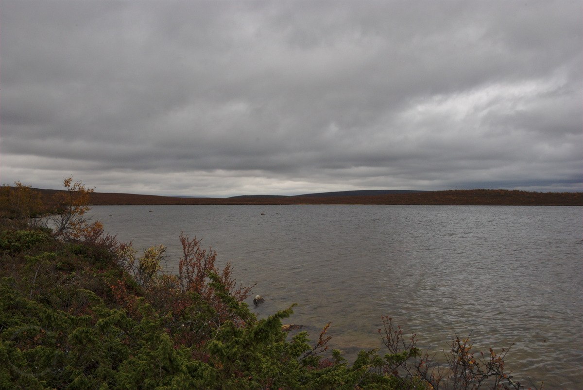
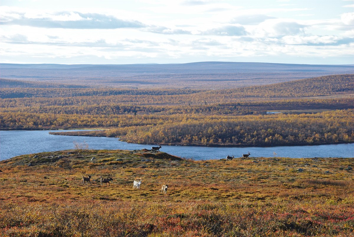
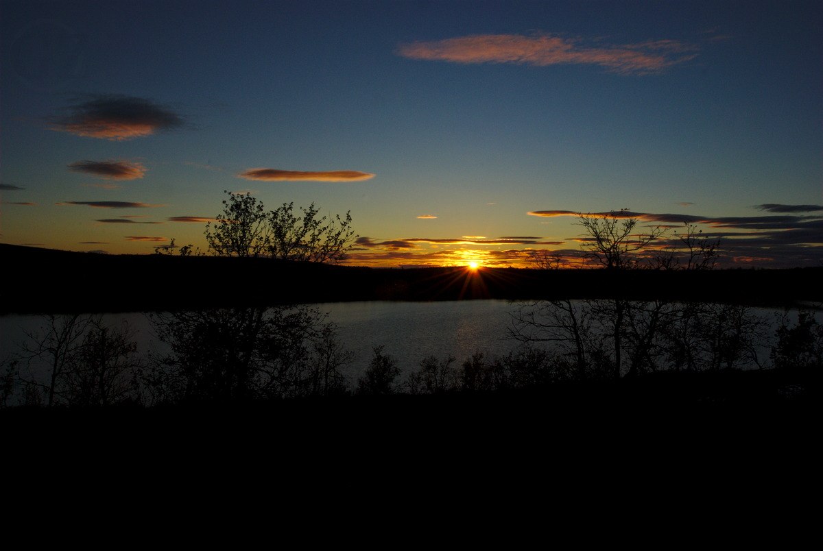
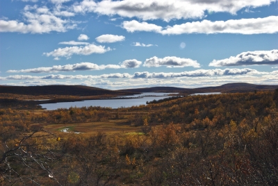
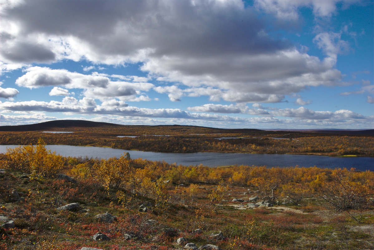
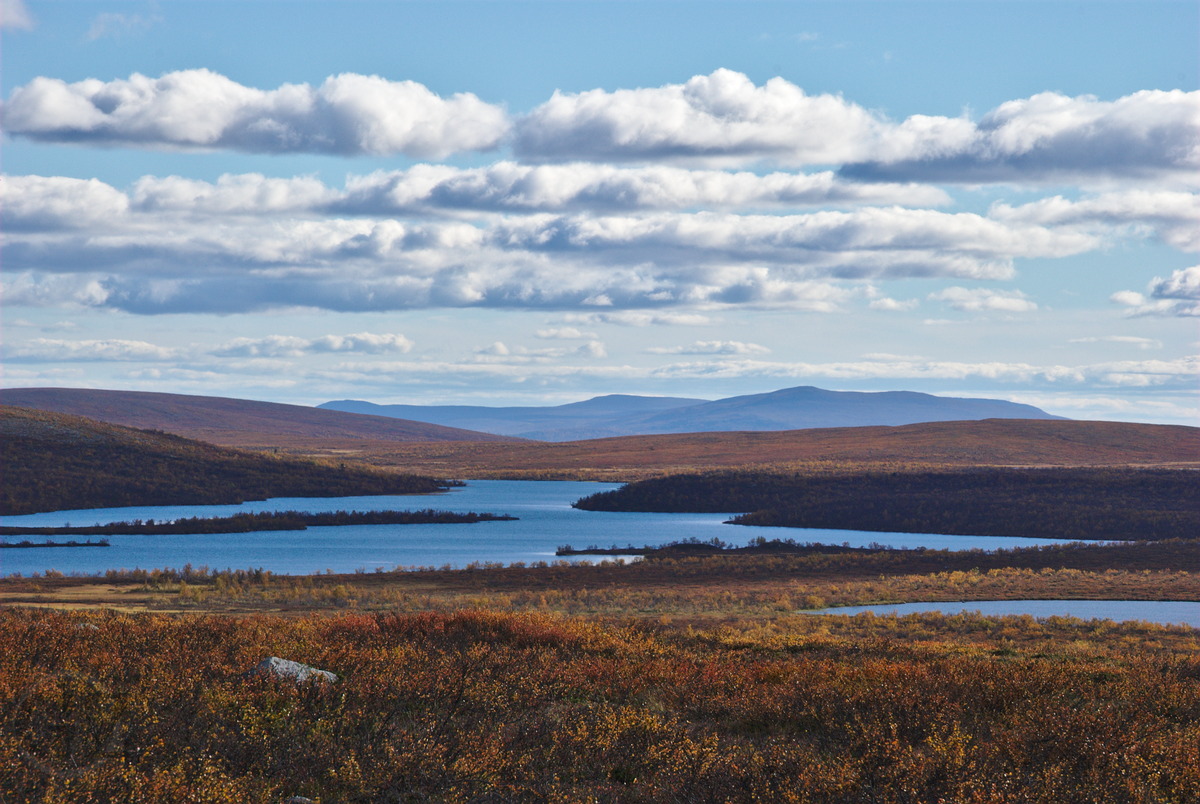
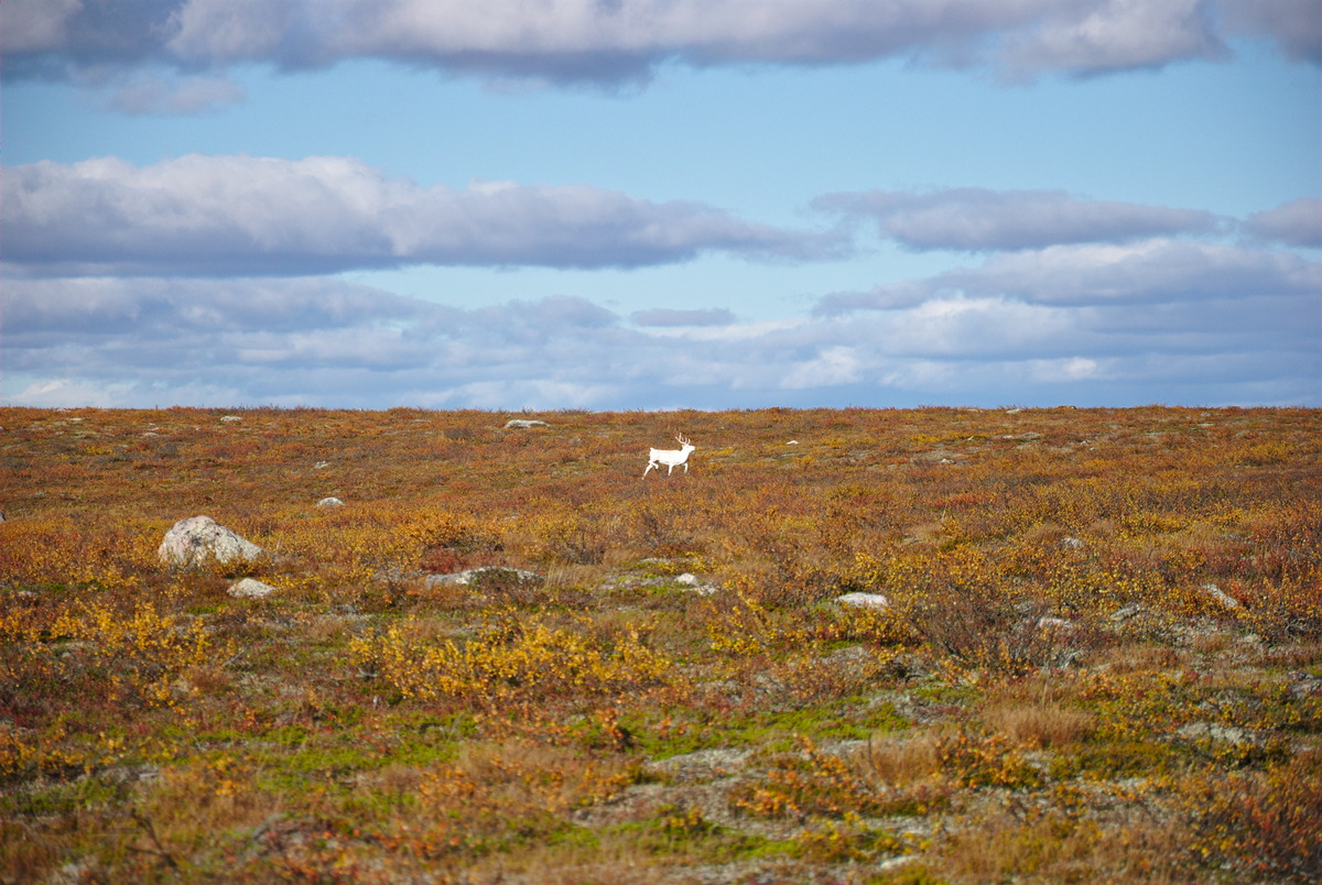
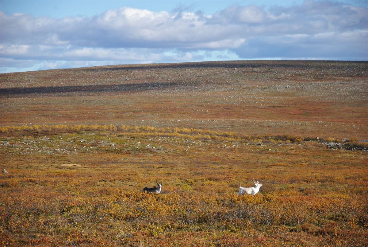
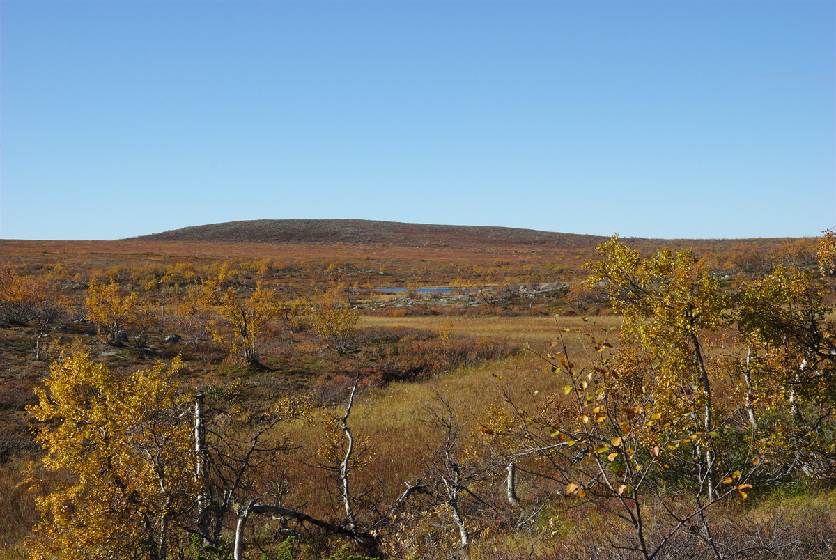
And already the next morning started with another big surprise: Two more friends who did not have time for hiking with us, went on a day trip starting from Näkkälä, and came by for a visit. While these visitors didn’t stay very long but left after an extended break (with some fishing attempts), also my other neighbour and hiking mate of my friend had to go back to Näkkälä that day. So my friend and me decided to leave our stuff at the campsite and to stay there for another night, and to accompany our common friend half way toward Näkkälä. We have thus postponed our return to Hetta for a day, but instead decided to walk around in the fells and tundra area, and finishing our way back to the campsite with a walk over Olkovaara. After I did hear some rain during the night, this day we had fantastic weather and made us a nice evening again on the shore of the lake Olkojärvi, just in front of our campsite.

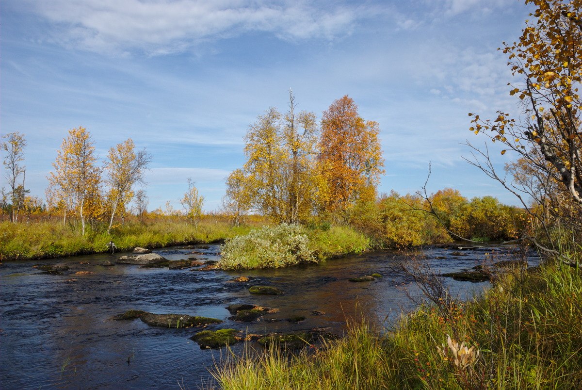
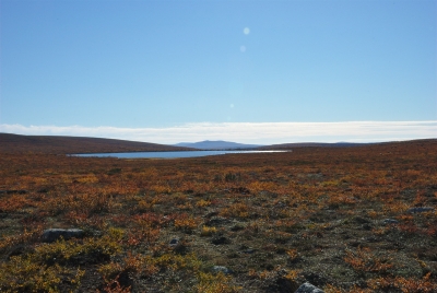
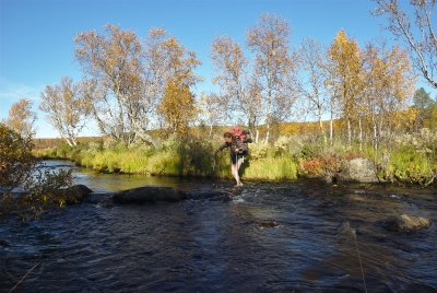
Because of having spent a second night on the lake, the next day we had to hike back all the way to Hetta, since my friend needed to be at work the next day. Once again we / I left a bit late, but never started to hurry. And once again we had a blue sky above our heads and most wonderful weather for our hike, of which we enjoyed every single second. Unfortunately the changed schedule didn’t allow us to hike back all the way off trails, so we decided to choose the same route I came to Olkojärvi.Ragatjávrrit The way back was much easier and faster, since now I already knew where to best cross the brooks and bogs. At Ragatjávrrit we made a short break, since I haven’t been swimming in the tundra yet this summer – and I certainly wanted to change these circumstances. Once again we didn’t manage to find the trail that is drawn on the map, and which should lead to a good spot to ford Näkkäläjoki, however, with having sun light and seeing the bottom of the river, it turned out to be much easier to cross at the very same place, where I had forded the river two days earlier in the other direction. After taking a few more breaks on the way to enjoy the beautiful Pöyrisjärvi wilderness area, we did speed up a bit when we came back to the hiking trail, which connects Hetta with Näkkälä. We actually even have been able to reach Hetta without the need of using flash lights. We were quite happy to reach Hetta in time, since this day the hike was rather long and exhausting, since half of it was once again off trails.
In the end, I was happy that I took a few days off from work and to meet with friends at the beautiful shore of Olkojärvi, just at the tree line and the gate to the tundra. The time couldn’t have been chosen better, as the colours of ruska – that’s how the colourful autumn is called in Finnish, made the hike to an extraordinary delight. I am already looking forward to the next time, when I will be able to enter this area for a hike!