
The peak of Pyhäkero is the most visible part of the Pallas-Yllästunturi national park when looking from Hetta toward South – toward the national park. Several trails are leading to – or over the Pyhäkero fell. For our weekend trip, we chose to make ski around the Pyhäkero fell, including one overnight stay at the Sioskuru open wilderness hut, instead of just taking the shortest way up.
The Trail: Sammalvaaranreitti & Onnasvaaranreitti

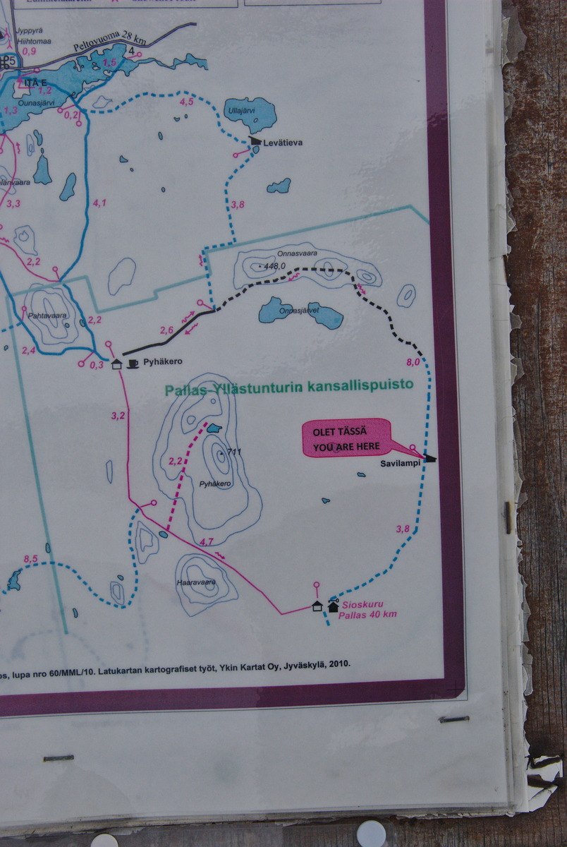
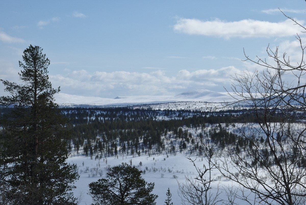
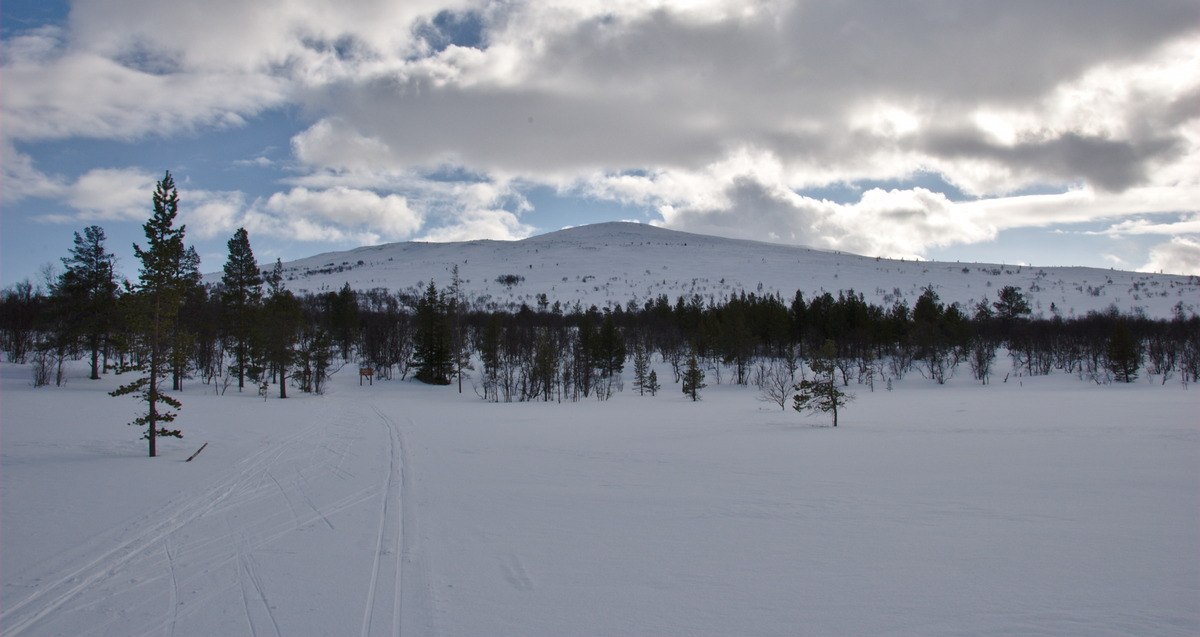
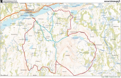
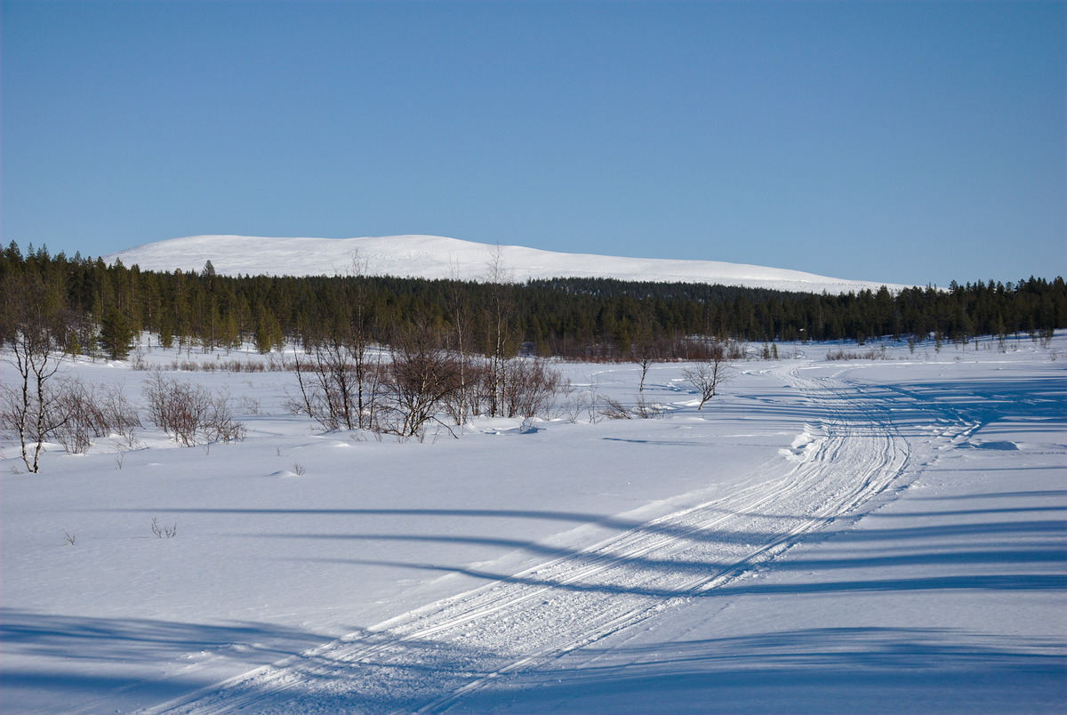
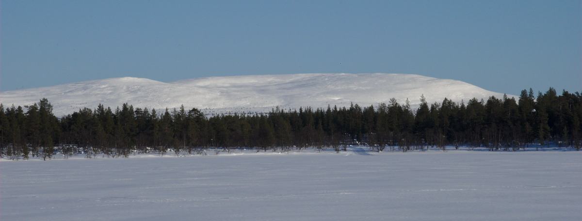
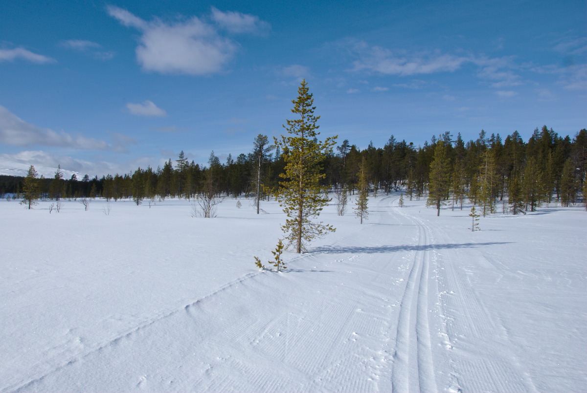
When looking from Hetta southward over the lake Ounasjärvi, the Pyhäkero fell is the first peak of the Ounastunturi fells, which are in the Pallas-Yllästunturi national park. Pyhäkero is the most visible peak around the Hetta village. The skiing trail as well as the summer hiking trail toward Pallas are going over Pyhäkero (though on different routes, and the skiing track doesn’t lead over the summit) and are quite popular trails. However, there are also some other skiing tracks going into the Pallas-Yllästunturi national park and to Sioskuru, where the first proper open wilderness hut is located. One of these tracks is the Sammalvaaranereitti trail on the West side of Pyhäkero. This track passes by the lean-to shelters at the lakes Rautujärvi and Postitupajärvi, and leads up to almost the highest point of the main track(appr. 600 m above sea level) on Pyhäkero, where these two trails intersect. Around the Eastern side of Pyhäkero is the Onnasvaaranteitti trail, which connects the Sioskuru autiotupa with the Pyhäkero day hut (päivätupa) North of the fell – or with the lakes Ullajärvi and Ounasjärvi. These two trails, the Sammalvaaranreitti and the Onnasvaaranreitti are both very beautiful skiing tracks, that combined make a wonderful trip around the Pyhäkero fell. With Heidi, we decided to divide this trip in two days, to be able to fully enjoy the nature and not just rushing through, even though with a distance of less than 50 km as a round trip (starting from Hetta), it also would be possible to do it in a day. The open wilderness hut Sioskuru in pretty much in the middle of this round, with approximately 24 km from Hetta via Sammalvaaranreitti trail to Sioskuru, and another 22 km via the Onnasvaaranreitti trail and Ullajärvi back to Hetta.
The Eastern Side of Pyhäkero

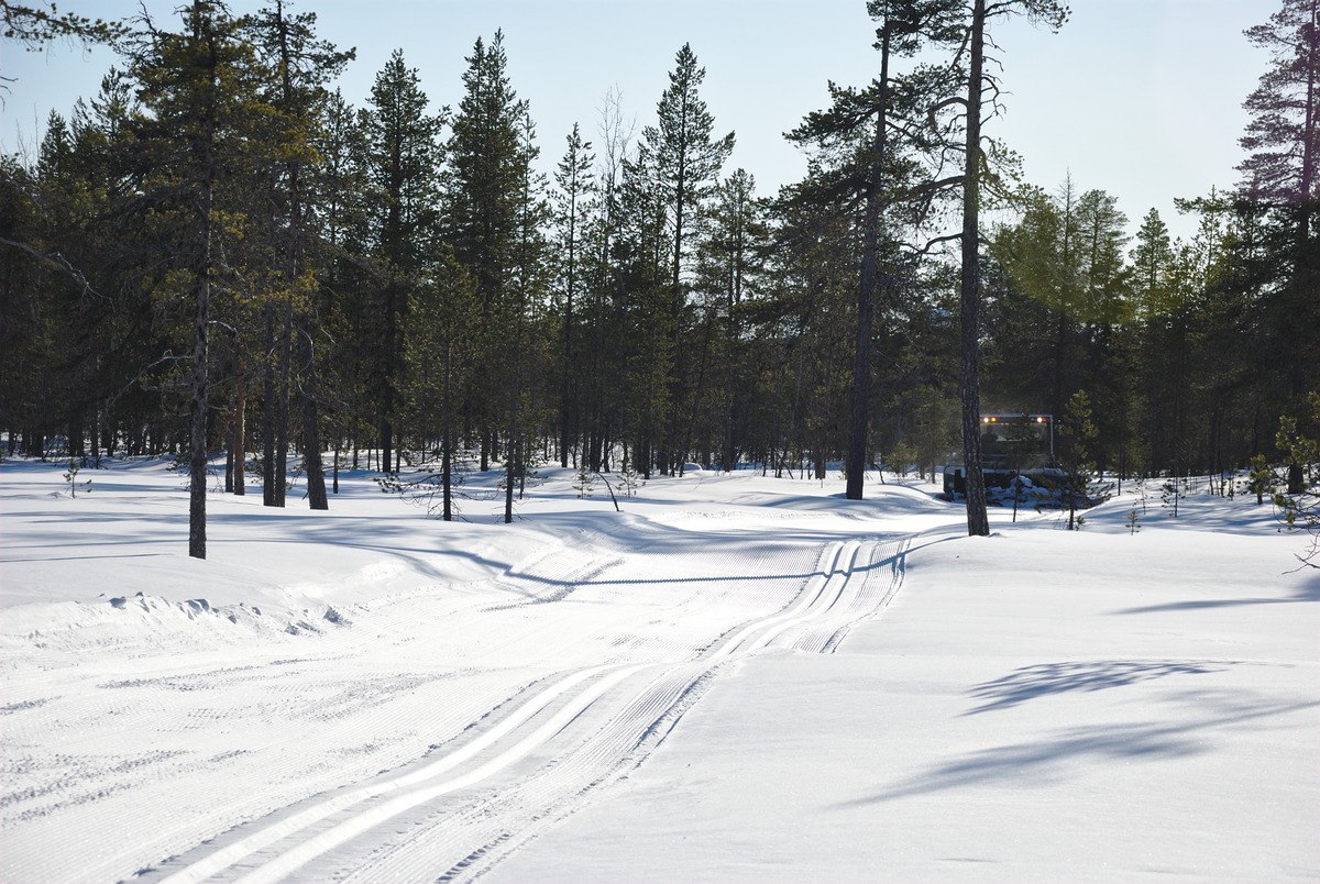
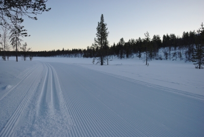
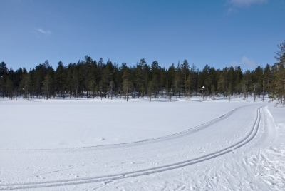
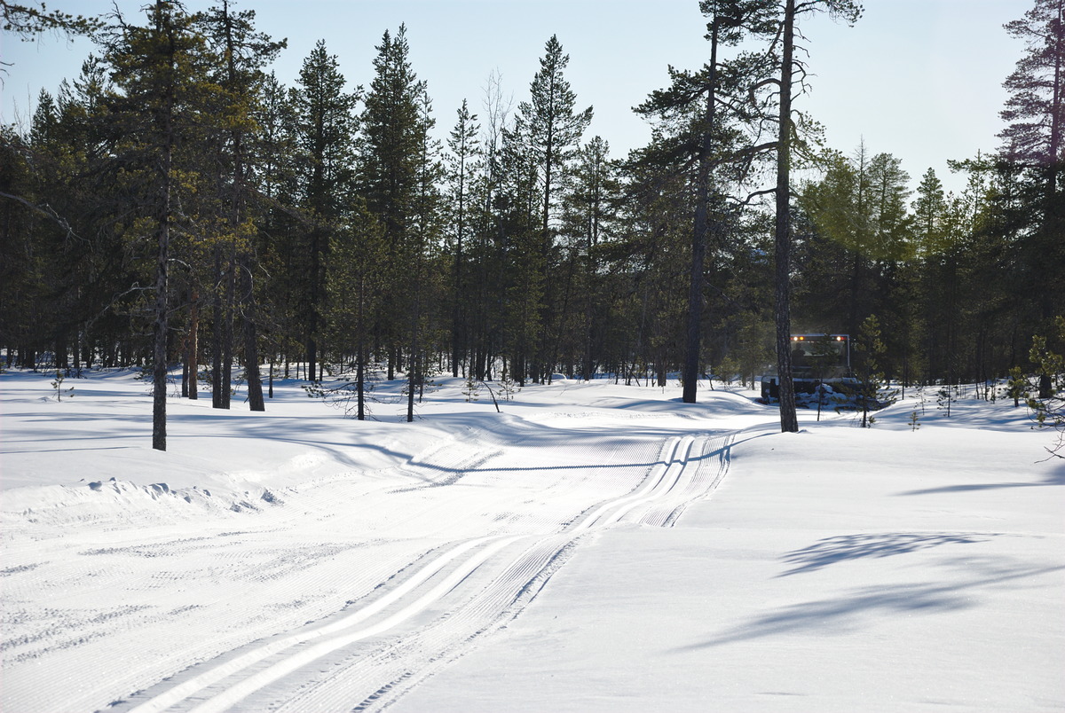
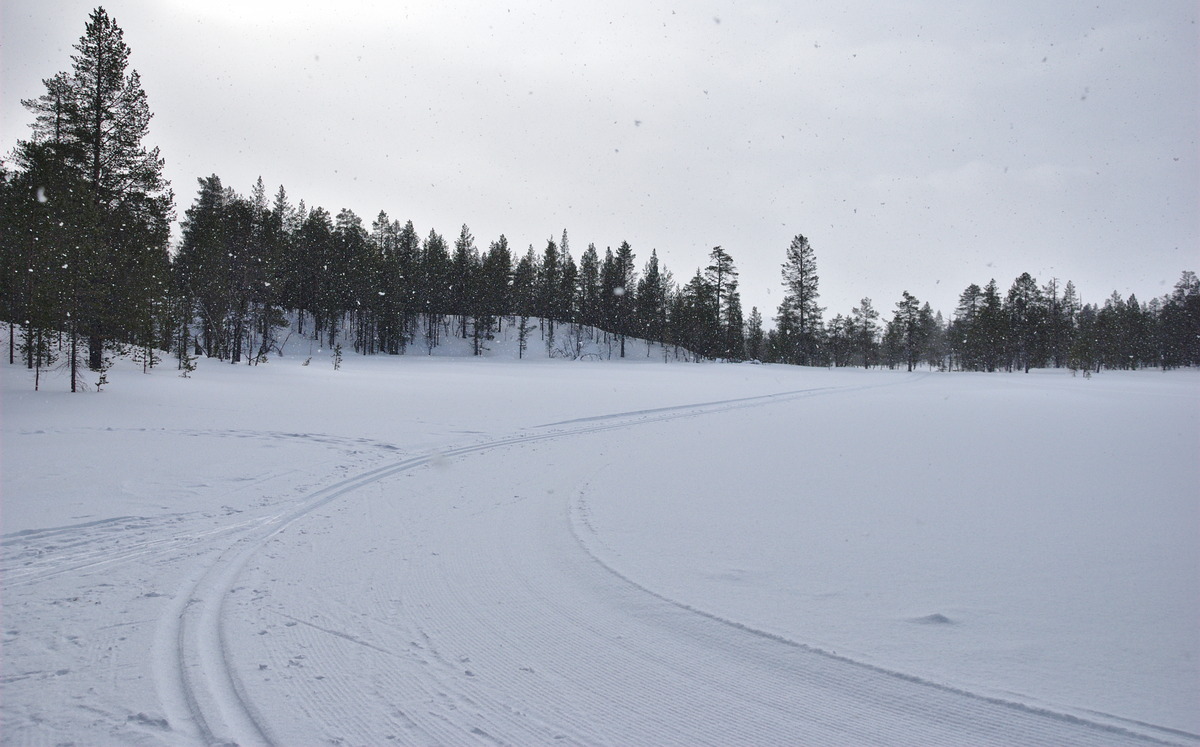
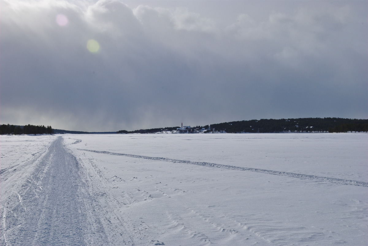
We started our trip from the center of Hetta, where we first followed the tracks over the lake to “Hetta East,” which is the closes entry toward the lake Rautujärvi. The tracks where in good conditions, until we left the main trail and turned to Rautujärvi. The tracks hasn’t been maintained in a while and was full with fresh snow. But who cares; we carried on, with already expecting that the track will remain in that condition for the whole day. However, to our surprise, we heard some motor noise behind us, and after maybe only one or two kilometers we let a snow groomer pass by us. On completely new tracks we quickly made our way to the Rautujärvi lean-to shelter, where the snow groomer had left our path.

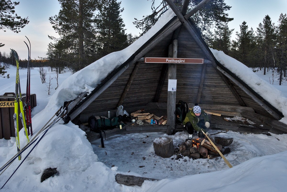
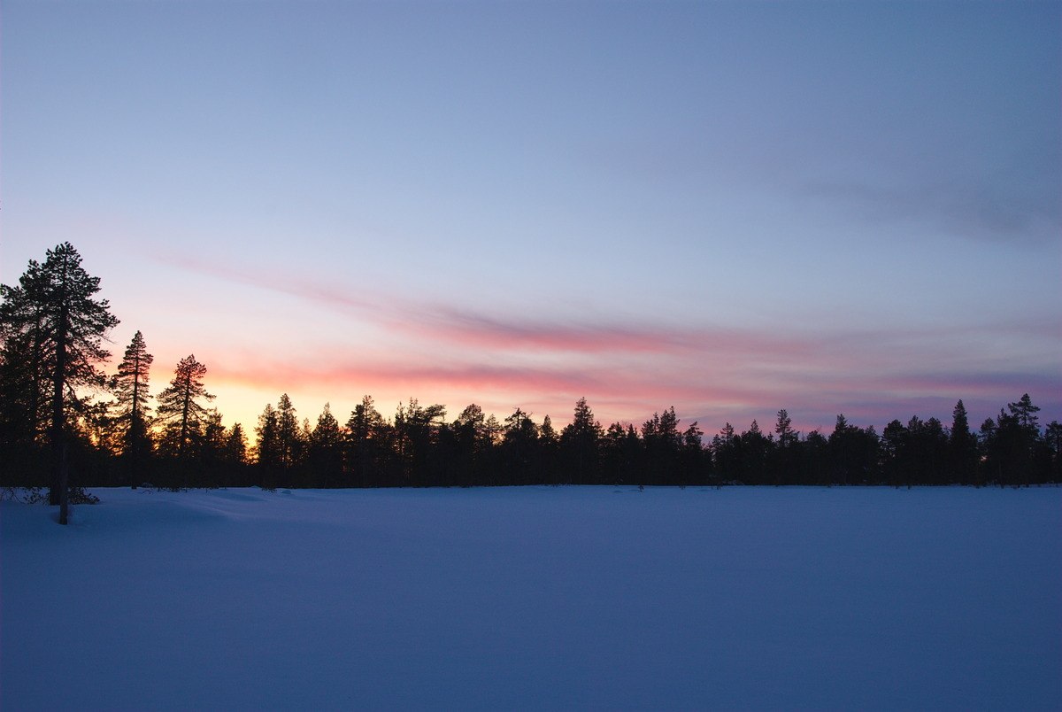
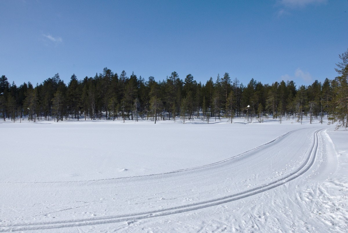
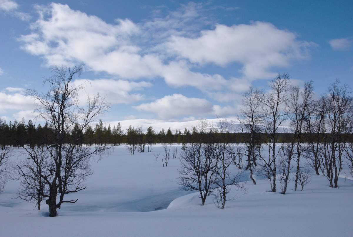
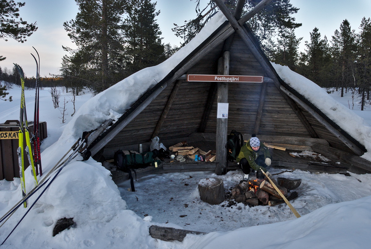
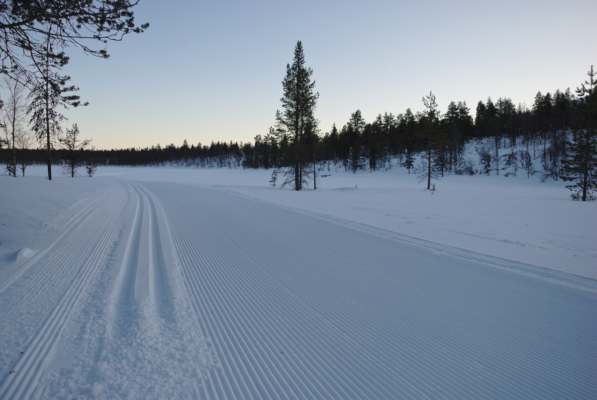
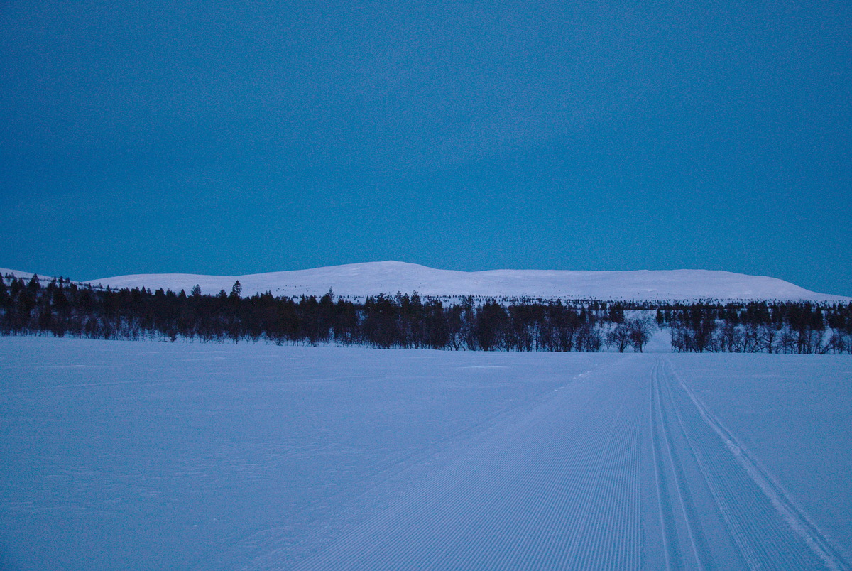
Back on the snow covered and old tracks, we continued to Postitupajärvi, where we made a fire at the lean-to shelter as we had planned. Unfortunately we haven’t been able to leave earlier but in the late afternoon, so while we were boiling some snow to prepare our tea after dunch (=dinner+lunch), the sun was already setting. And in this quiet and peaceful sundown, we got surprised by suddenly hearing some strange mechanic noises again: The snow groomer we saw earlier once again passed by us, and made us more new tracks all the way up onto the fell, where the Sammalvaaranreitti trail intersects with the main skiing track towards Sioskuru and Pallas. We found ourselves happy in this situation, as the perfect tracks allowed us to entirely concentrate on the landscape and not to worry too much about skiing, as we were sliding almost as on rails through the national park.


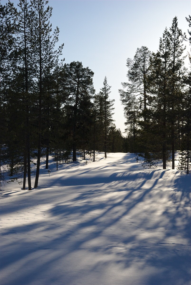
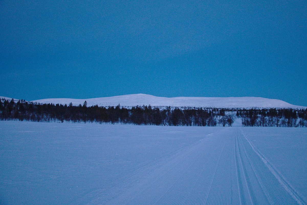
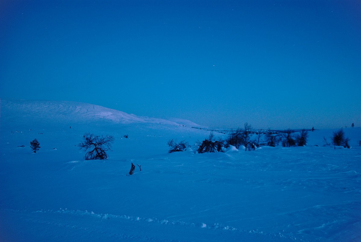
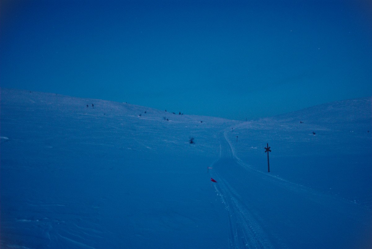
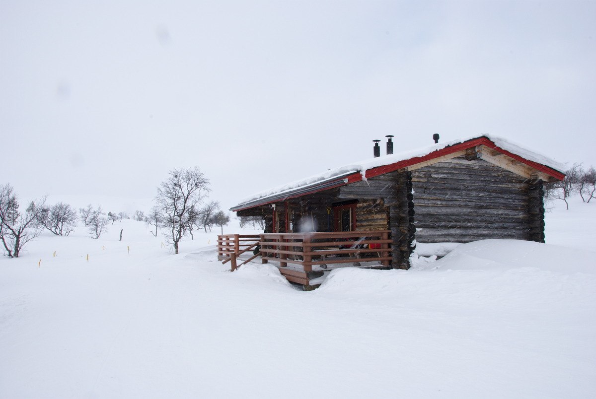
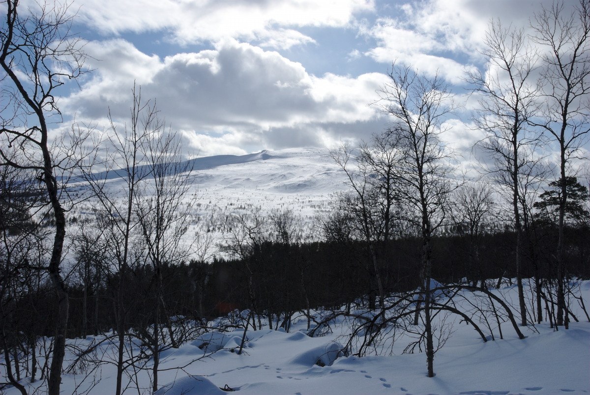
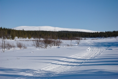
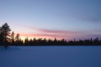
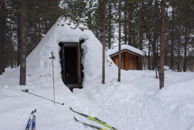
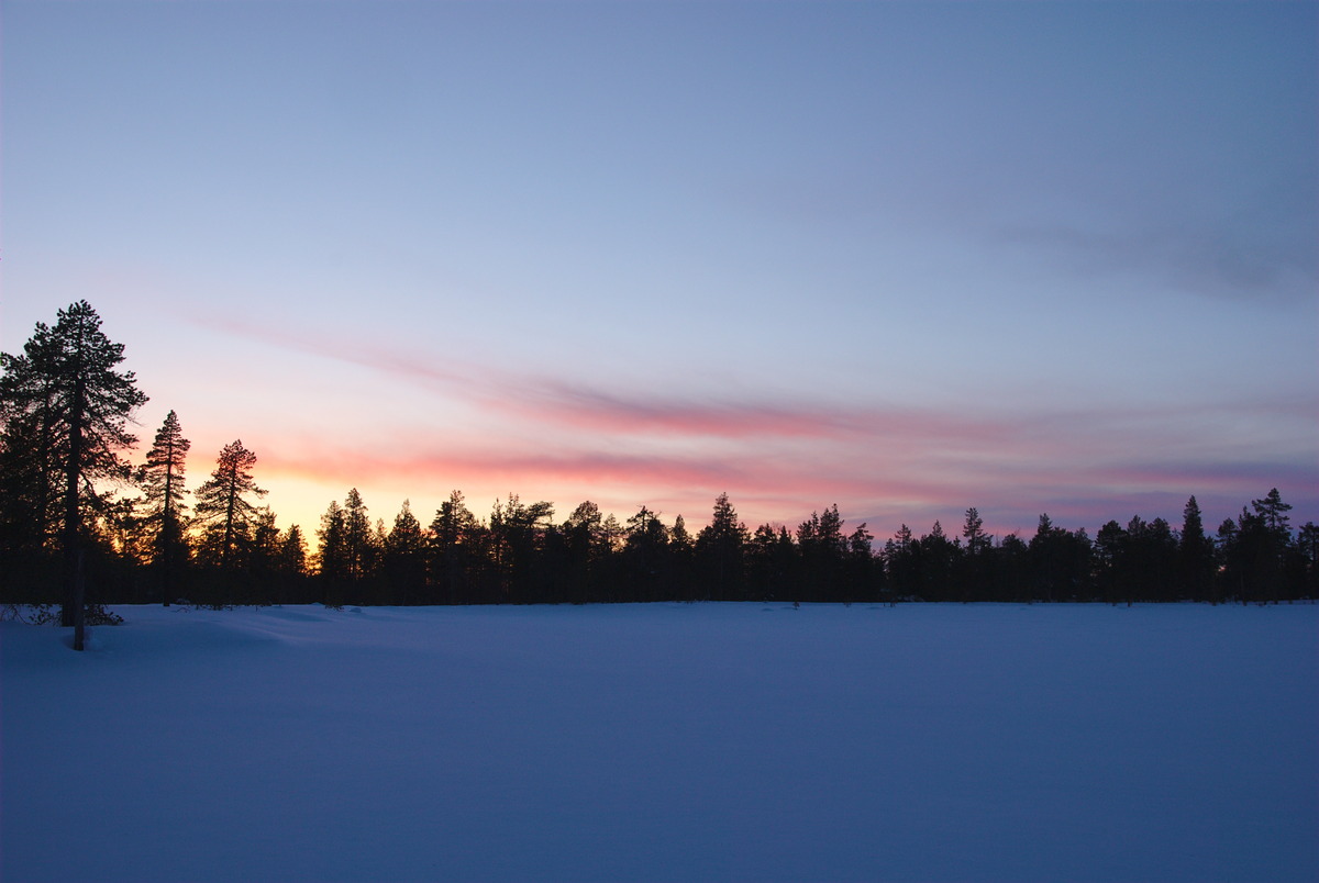
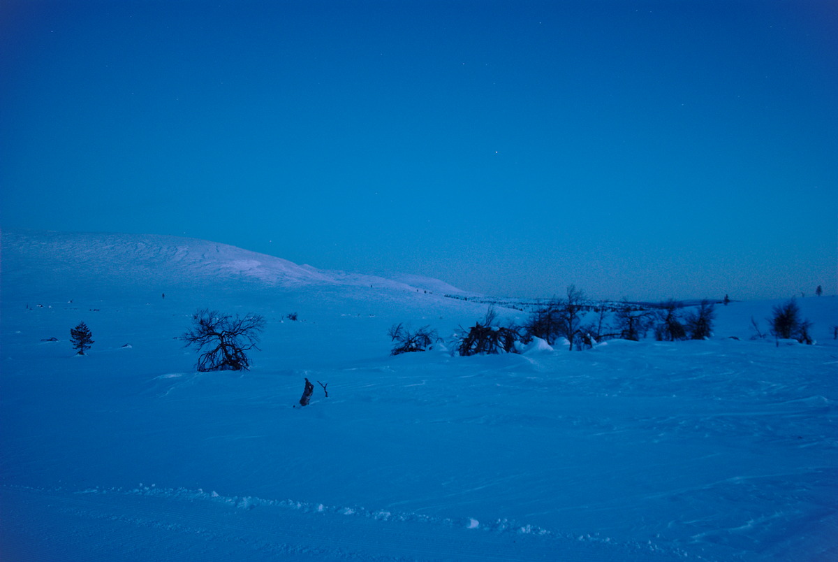
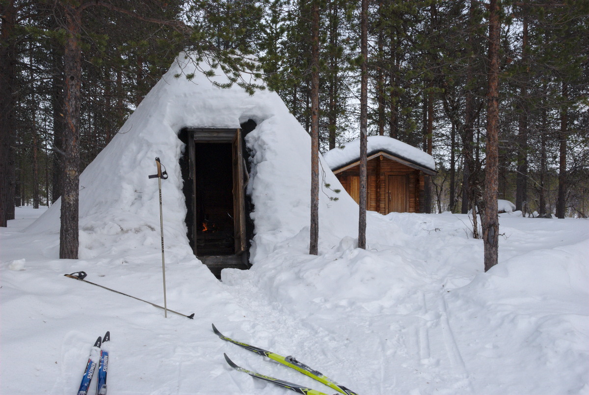
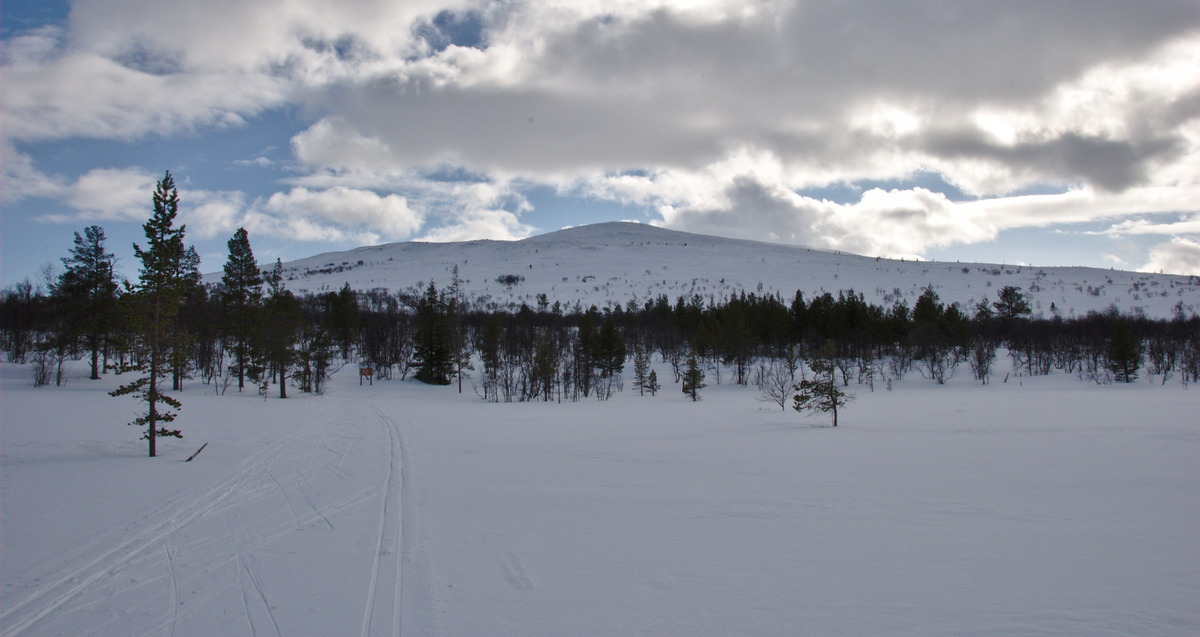
From Postitupajärvi the trail slowly leads up in the fells, while the thiner and thinner getting forest and the snow covered wetlands offer a constant view to the bigger appearing and closer getting fells, until finally reaching the tree line. Since it was already after sun down, the light was slowly getting weaker while we were skiing up the fell. Nevertheless, we got enough atmospheric light also during the night, to make it safe to Sioskuru, since that day pleasured us with a clear sky and plenty of bright stars. To our surprise we arrived at an empty autiotupa in Sioskuru, though the skiers in front of the hut revealed that in the reservable hut some people must have been sleeping.
From Sioskuru Via the Western Side Around Pyhäkero

In the next morning, we got woken up when suddenly a lot hectic noise appeared in the front of the open wilderness hut. As we figured out a few minutes later, the people sleeping in the other side of the hut were part of the organization of a skiing race, that took place that day. We know that there was the Sámi skiing race planned on Sunday, but that was toward North, to Kautokeino; we also knew, that there were some competitions this weekend around Muonio and Olos from the Lapponia ski week; but we didn’t know, that part of the Lapponia ski competition, the 80 km race to be precise, was going by Sioskuru that morning, going from Hetta, via Pallas to Olos. Well, at least now we knew. So while the competitors where sweating by our overnight shelter, we were preparing our small breakfast and as the only spectators in Sioskuru, watching this event halfheartedly throughout the window, while getting ready to leave. Even though only 4 km away, our plan was to stop at the Savilampi kota, and have our lunch there (we expected the open wilderness hut to get busy soon by the first day trip skiers).


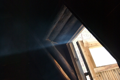
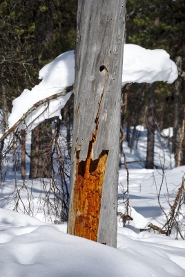
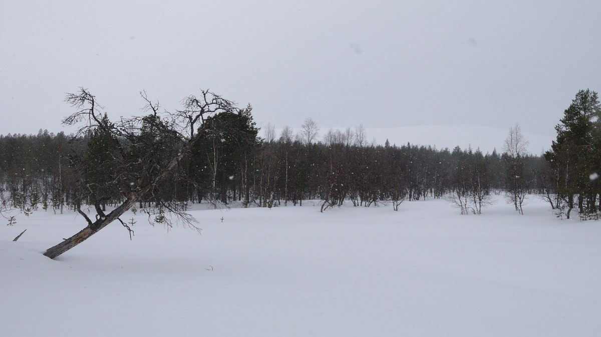
When we left the hut and put on our skiers, it was snowing. This was of no surprise at all, since I have never spent a night in Sioskuru without having precipitation on at least one of the days being there. So, under the obligatory snow fall we left the Sioskuru autiotupa “early” in the morning and headed towards Savilampi. While we were grilling our sausages and making tea inside the dark kota, we discovered that there was some strange kind of electromagnetic radiation coming through the opened door, when I suddenly realized: The sun must have come out! When we left the kota after our lunch, we found ourselves standing under a blue sky with only some clouds, being happy that we took some sun lotion with us!


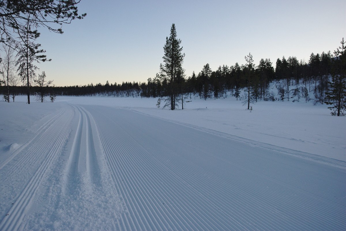
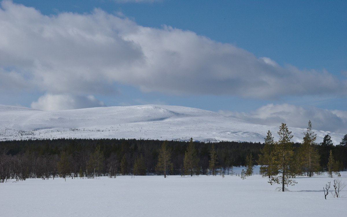
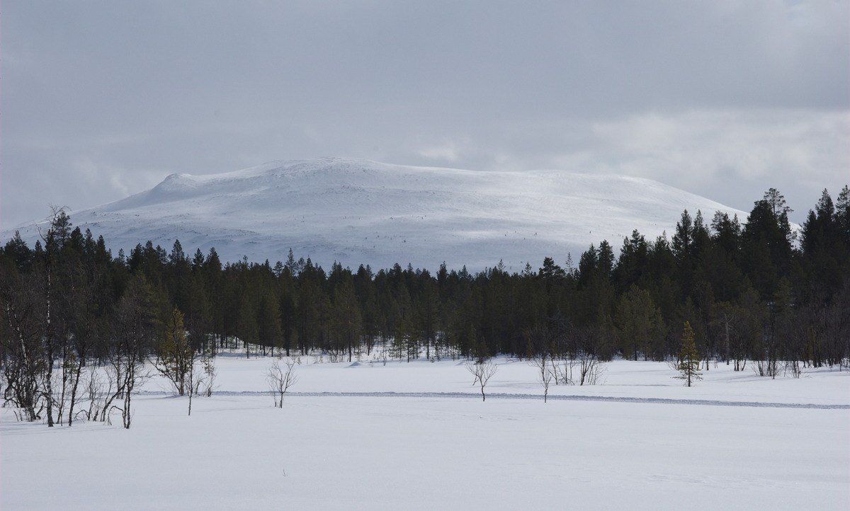
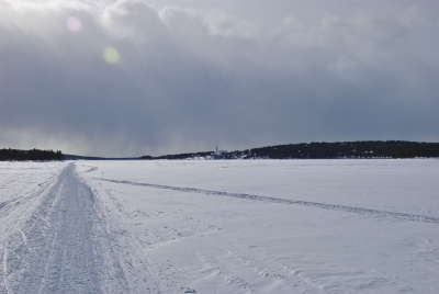
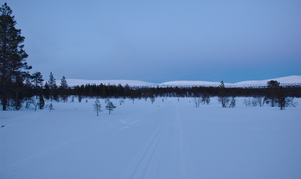
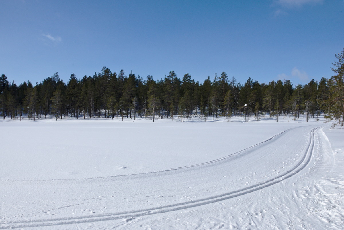
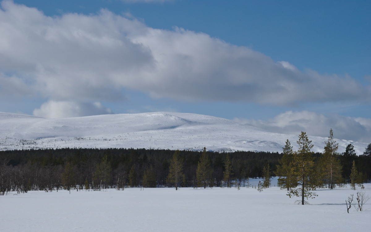
The Onnasvaaranreitti trail goes mainly through pine tree forest, where only a few spots offer a nice view on the Pyhäkero fell, but still it is a very beautiful skiing track through forest, that, on the Western side of the fell, also offers a nice view over the Ounastunturi fells, where the panorama even allows a few of the Rouvikuru ravine, which is just before entering the valley where Hannukuru is situated. Since this day we were skiing the whole day on rather good tracks, we advanced pretty fast and soon reached the North-Western side of the Pyhäkero fell, where we decided to turn South to the lake Ullajärvi instead of heading to the Pyhäkero day hut. At Ullajärvi we made a short break at the Levätieva lean-to shelter and ate the rest of our self-made Pulla that we had with us, while thick clouds slowly started to take over the sky again. It turned out that we had a good timing this day, as we made it back home just in time before it started snowing again.
Trip Résumé

We were very glad that we chose to take this round, as both, the Sammalvaaranreitti and the Onnasvaaranreitti trails are embed in a beautiful landscape with nice views on the fells, where you also have ski up the fells to pass them. While the Eastern side reveals more open space (wet lands, thinner birch forest) with almost a constant view to the Pyhäkero fell, the Western side rather leads through (besides the skiing tracks) almost untouched pine tree forest. Since most skiers are either only going to the Pyhäkero day hut or crossing the national park, these side tracks are less frequented than the main trail. Since there are also a few lovely lean-to shelters, these tracks are fantastic for short- or day trips.
Picture Gallery